Monday, April 02, 2012
April Fool's Day Ride
Sunday, June 04, 2006
Yosemite 5-20-06
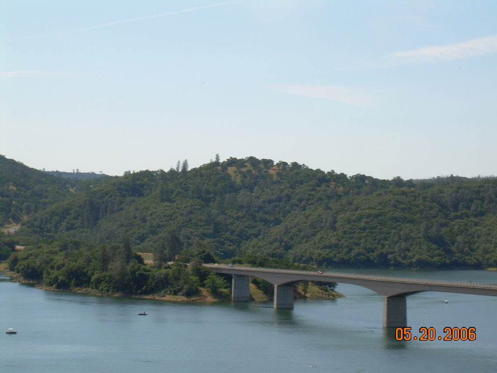
The reservoir on highway 49 was nearly full, a sight I had not seen before.
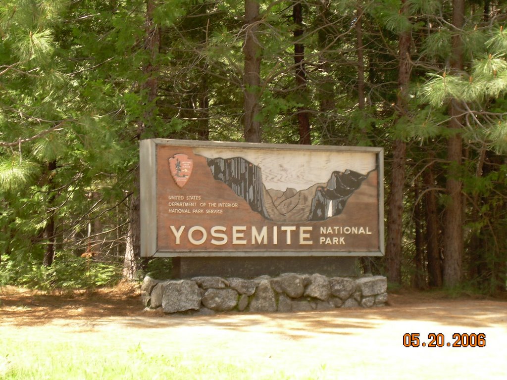
My goal.
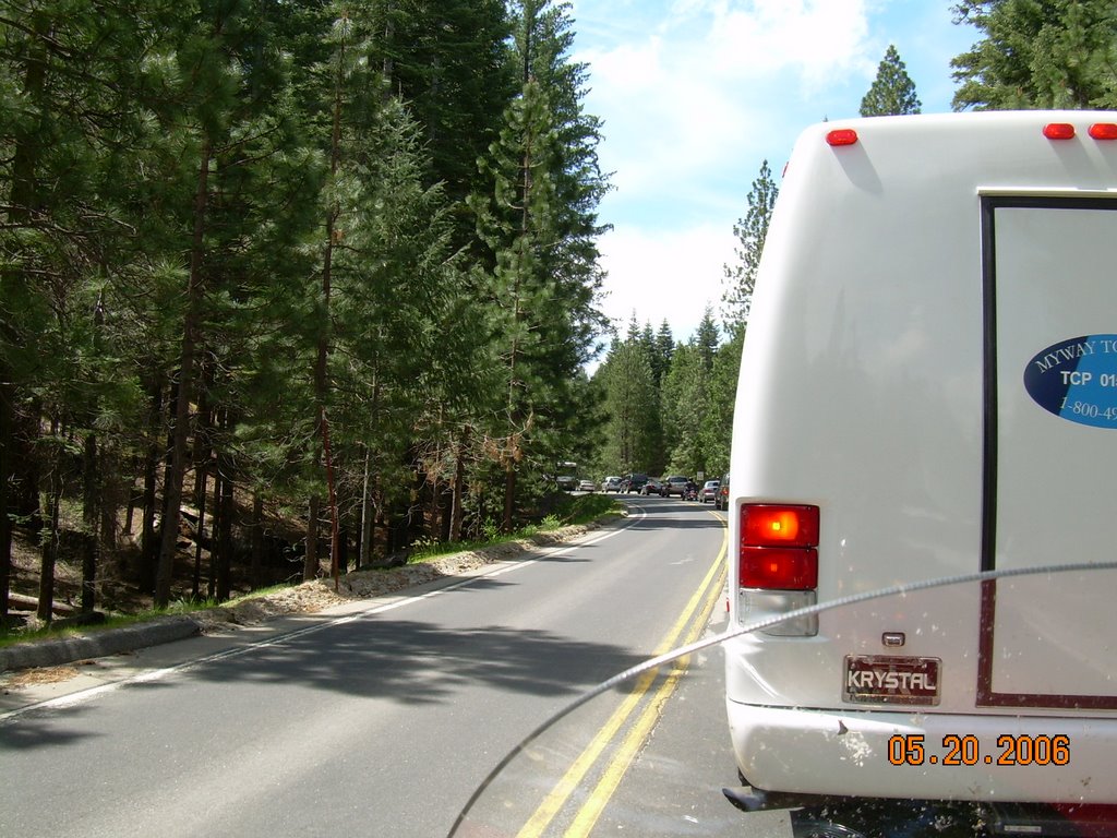
The traffic at the entrance, which was increased because the other western entrance to the park was closed by a rockslide.
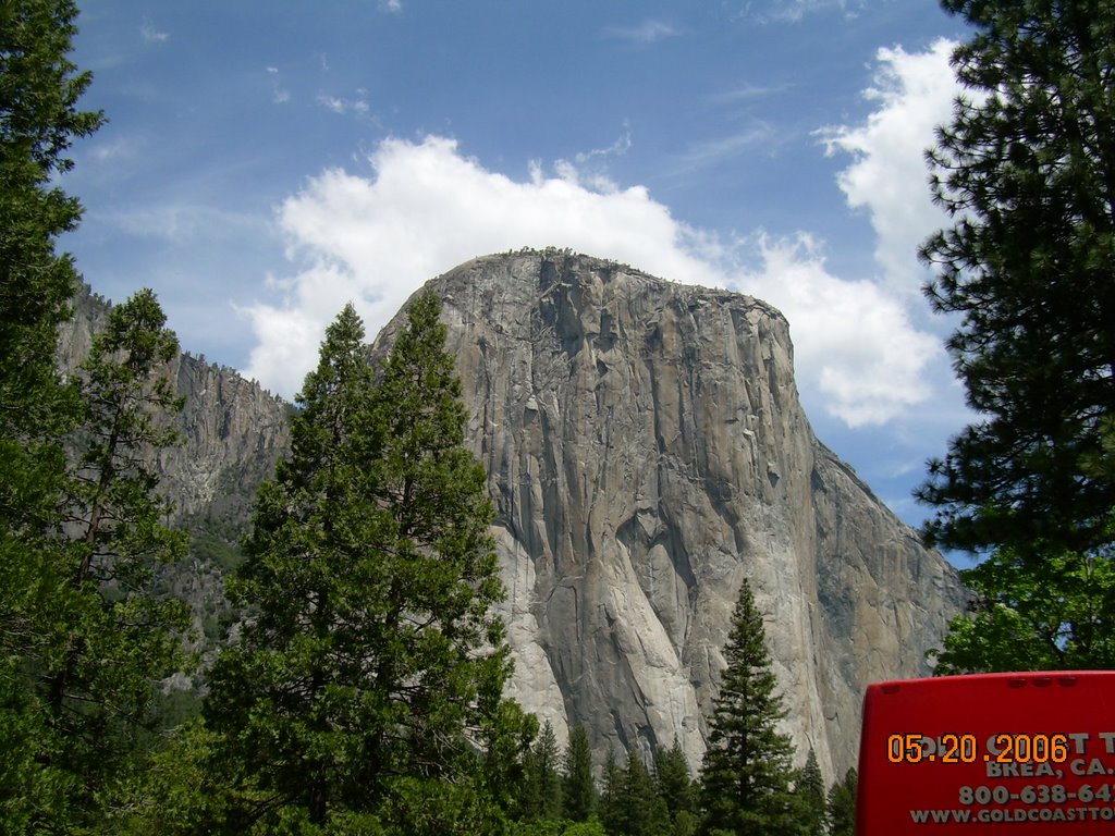
El Capitan.
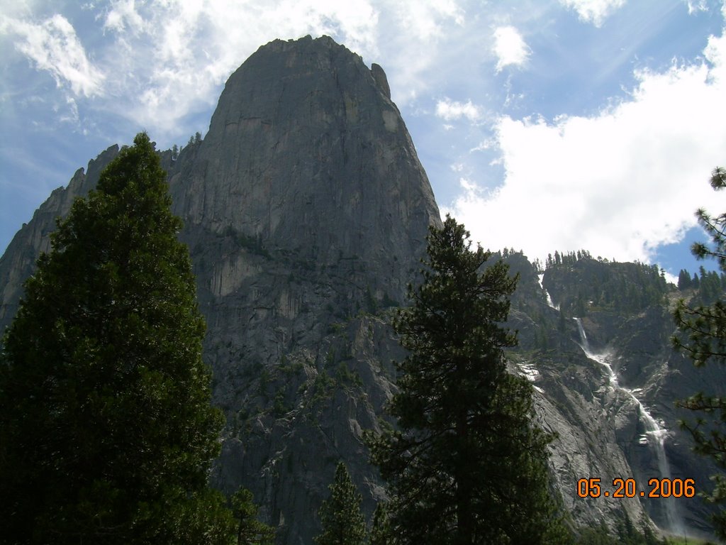
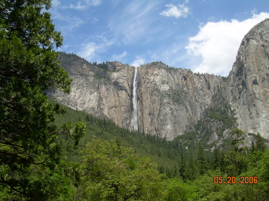
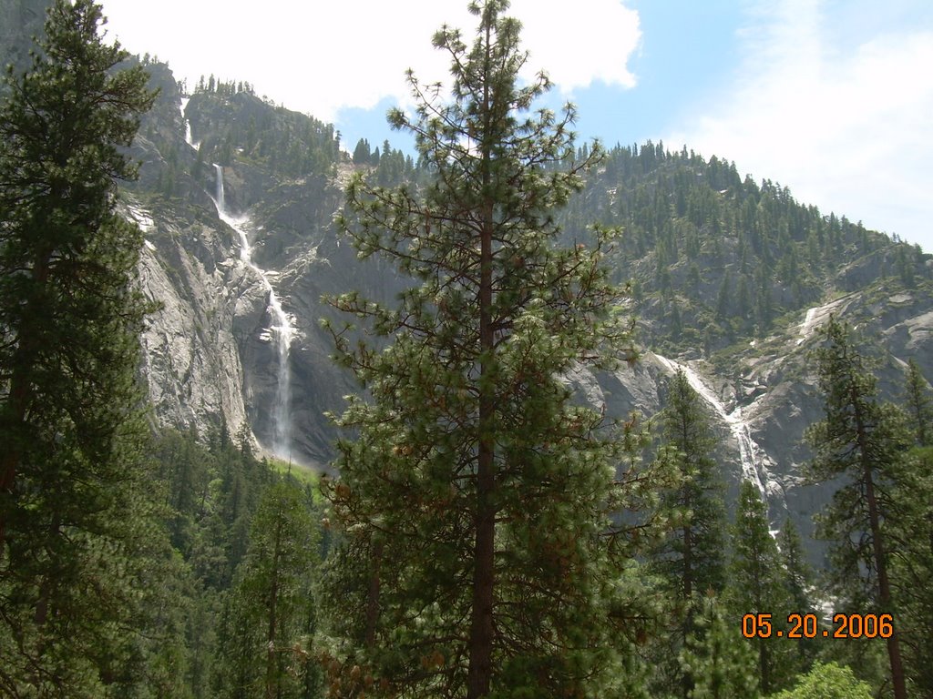
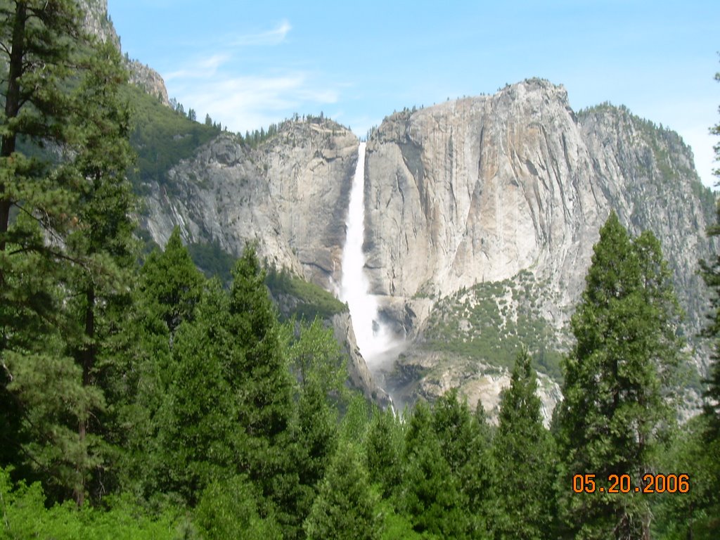
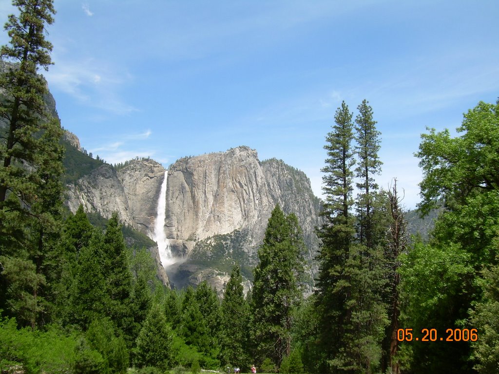
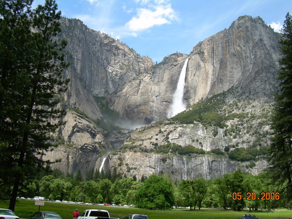
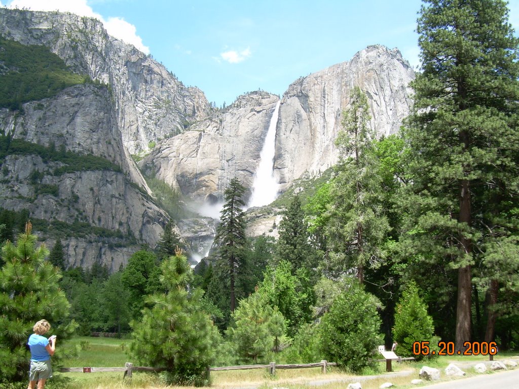
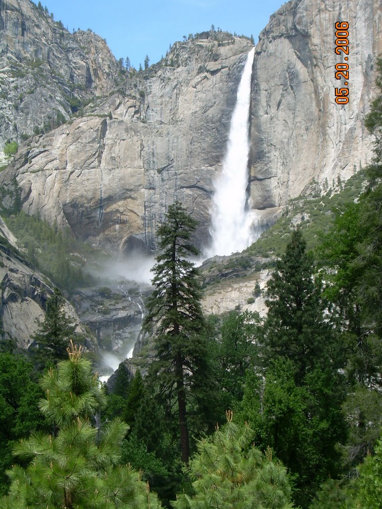
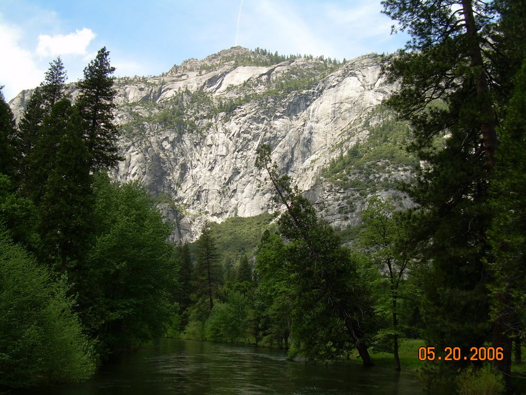
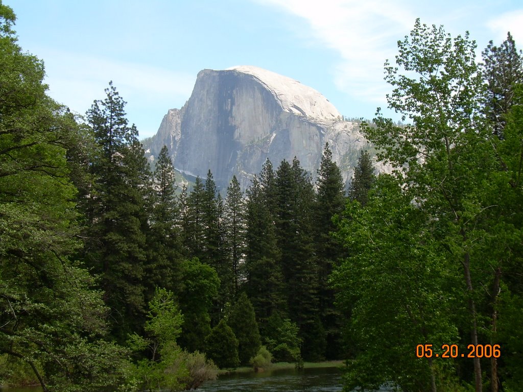
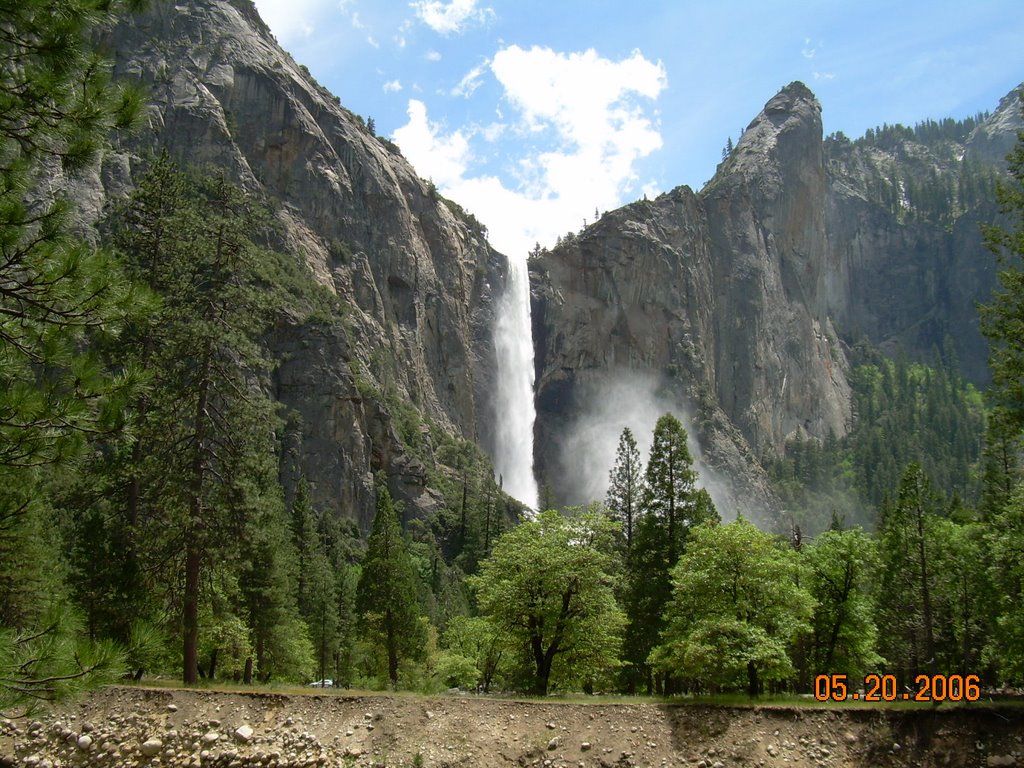
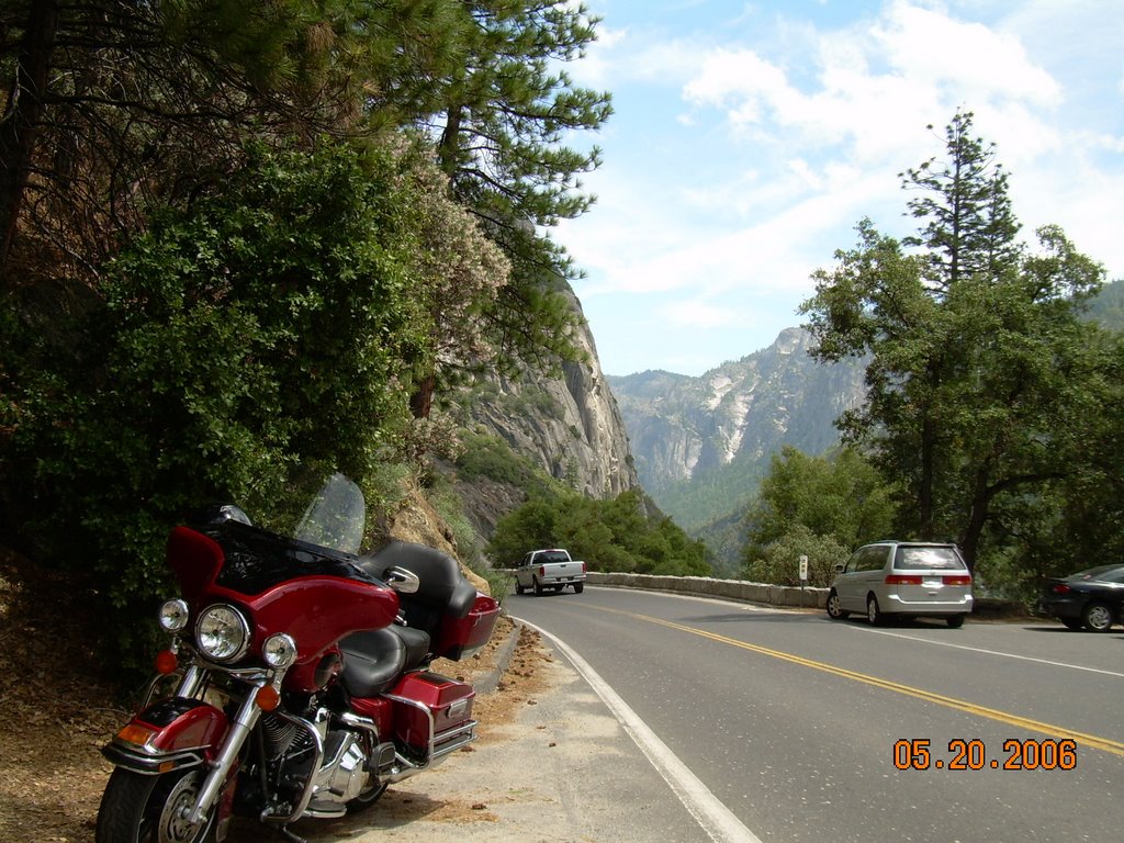
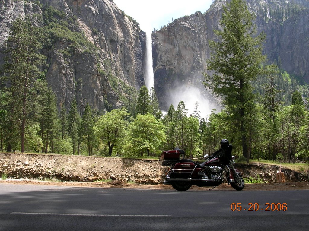
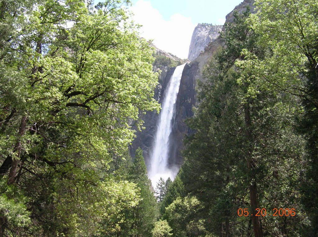
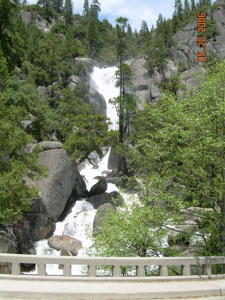
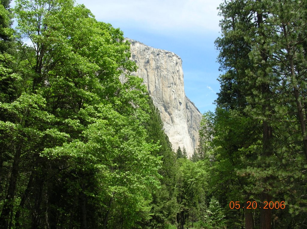
Words don't describe Yosemite, so I let the photos tell the story.
On the way home, I fought Frog Jump traffic on hwy. 49, then spent a couple of hours visiting with the good residents of Jackson, enjoying the evening on the patio while John and Dennis got John's bike ready for his cross country ride.
Saturday, May 06, 2006
4-29-06 Foothills Ride
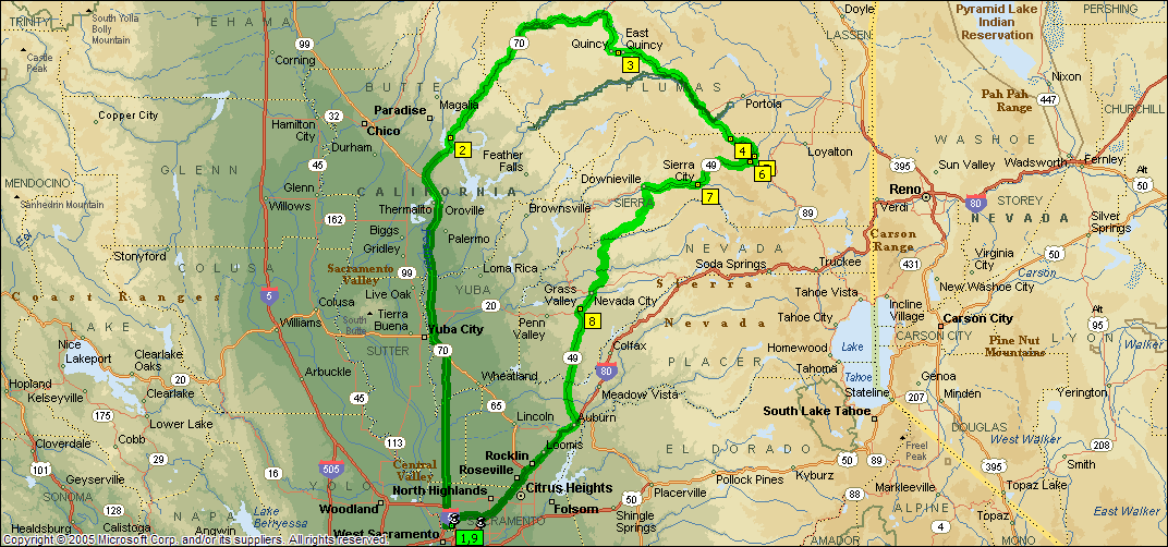
On a warm Saturday morning, I left Sacramento with an idea to ride to Quincy, CA. I grew up near Quincy, Illinois, so I thought I'd check out the California version.
To get there, I left Sacramento heading north on CA route 70. It was an enjoyable ride through the farms and orchards on the flatlands until I got to Oroville. Shortly after Oroville, the road joins the Feather River. This is a real nice ride up the canyon, with nice, easy curves. There wasn't much traffic, so I took my time and enjoyed the view.
One interesting facet of this road is the railroad on the other side of the river. The road crosses the river several times, and at least two of those times the rails cross the river at the same place, with bridges that cross each other. Kinda neat.
There are several tunnels, which cause some vision problems coming from the bright sunlight.
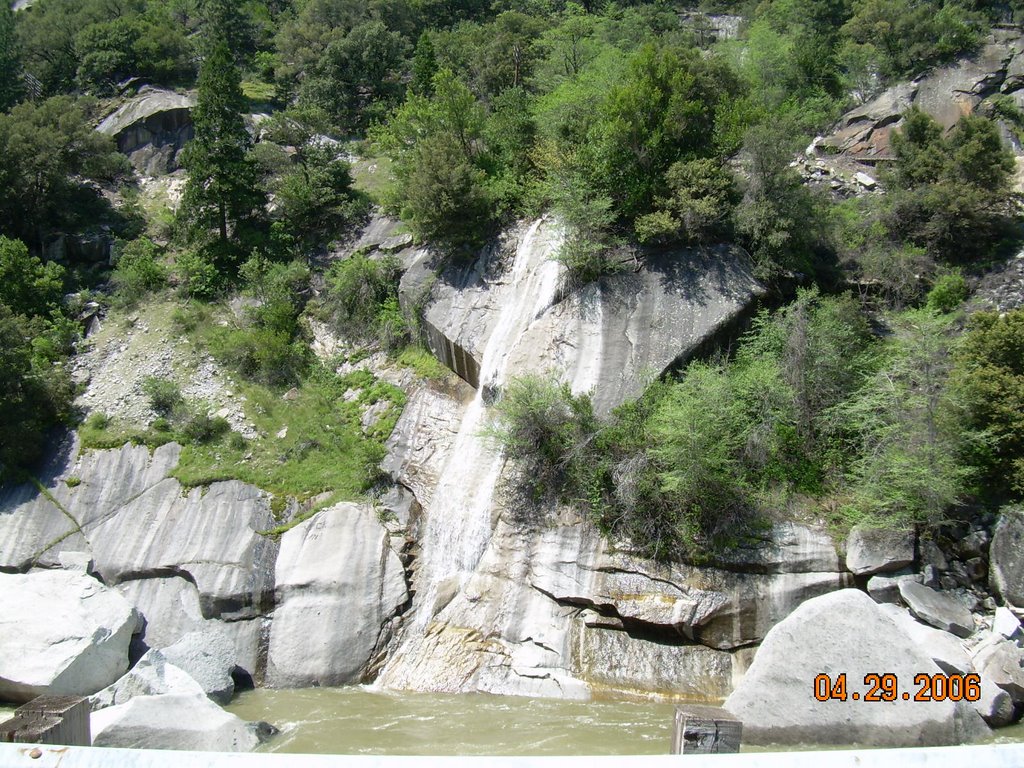
The snowpack is melting, and there were lots of waterfalls cascading down to the river.

I made it to Quincy, a nice mountain town, very different from its Illinois namesake. From there I continued on Rt 70, which had combined with route 89 north of Quincy. This was a more open road, with little traffic, and was pleasing to ride.
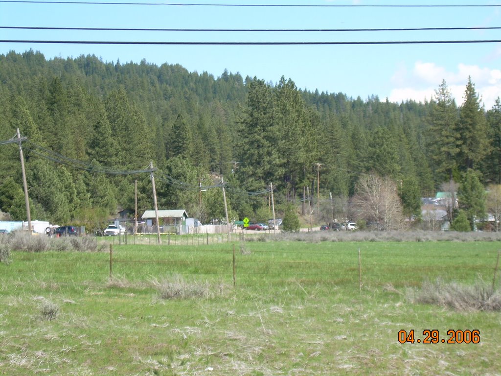
At Graeagle, 70 and 89 part, and I turned right to stay on 89. This road runs through some mountain valleys, with broad open valley floors with cattle and horse farms, with forests on the hills surrounding. I felt like I was on the set of Bonanza, and kept expecting to see Hoss and Little Joe on their horses. It was quite green and beautiful.
At Calpine, 89 meets with Route 49, where I turned right and started climbing.

Right after the turn, a sign was nailed to a tree: “Bikers Beware: Dead Mans Curves Next 15 Miles.” That's the kind of sign a motorcyclist likes to see. I rode up the mountain to the top, where there were 10' tall snowbanks next to the road, and a snowmobile park where folks were riding snow machines. As I headed down the other side I saw more waterfalls. I'm running out of words to describe the mountain roads of California without repeating myself, but they are excellent rides.
It was this stretch of road where I got 45 mpgs, mostly because I was only;y going about 45-50 mph. I usually get 37-40. I needed the mileage, because I stretched the gas stop to 180 miles. I just knew I was on fumes, but when I finally got to a station, I only put in 4 gallons. I still had 40 miles in the the tank.
Once in civilization again, I went through Grass Valley and Auburn, and took I80 back to Sacramento.
330 miles, and some real nice mountain riding. Of course, I forgot my sun block, so I had raccoon eyes. Next trip, I am going to explore some of the side roads.
Sunday, March 12, 2006
Christmas Eve Ride
I dawdled until around 11, waiting for the roads to dry off a bit, then went and got the bike out. I headed north out of Sacramento on the Garden Highway, which is a fancy name for a levee road. The road runs atop the levee alongside the Sacramento River until the Feather River splits off, then follows the Feather River. Since the road follows the river, there are lots of sweeping curves, but not much vertical relief. After all the rain we've had around here, the river was swollen and the water level was higher than the ground level on the other side of the levee.
The road was damp, but in pretty good shape, until I hit the Sutter county line, where the pavement became quite pot-holed and rough. I had to slow down a bit, but the suspension ate up the bumps.
The houses on the river side of the levee varied from real nice homes, on built up earth, to equally nice homes on stilts, to not as nice homes on stilts, to mobile homes that looked like they could be pulled out real quick if the water was to rise that high.
After about 30 miles of the levee road, I came to highway 99, which I took north across the river and toward Yuba City. After 10 miles of highway, I turned back onto the Garden Highway, which on this side of the river is below the levee and runs through orange groves and vineyards.
As I approached Yuba City, I observed that although it was still cloudy to the west, the clouds to the east appeared to be breaking up. I had looked at a map and was thinking of riding west from Yuba City to Clear Lake, then to Napa, but decided that sunshine would be the rule of the day and headed east on highway 20 towards the foothills. After leaving the rice paddies behind, route 20 rises through some nice turns and hills toward Grass Valley. About 25 miles from Yuba, Indian Springs Road heads south, so I took it. I had noticed this road on the map, and thought it might be a nice byway. It was. It wound through the woods and horse and cattle farms. I love to ride on back roads, there's no traffic to worry about, there is much scenery to look at, and if you are not in a hurry, they will get you where you want to go.
This road reminded me of some of my favorite roads in the Texas Hill Country, the terrain was similar although it is a lot greener here.
For those following along at home, Indian Springs road runs into McCourtney Road, which runs into Lime Kiln Road, which takes me to Highway 49 north of Auburn.
The ride on 49 to Auburn isn't much to write home about, but that is made up for just as soon as you leave Auburn going south on 49. The road drops down the side of a mountain, with switchbacks galore, only to cross the river at the bottom and head up another mountain, with even more swichbacks. The road calms a bit after that, and becomes a really nice ride, with curves and ups and downs, through some very pretty country.
I passed the Marshall Gold Discovery State Park where in 1848 James Marshall discovered the gold which led to the California Gold Rush. I will return here when it is not a holiday to take in the exhibits.
Upon reaching Placerville, I checked my watch and decided to head for home. I took rt. 50 and slabbed it back into Sacramento, remembering to vary my speed and not go too fast, as I am still breaking the bike in. For the most part I kept it under 75, and made it to the barn OK.
About 180 miles, in 60 degree weather, most of it in the sunshine. A nice Christmas present.
I hope each of you enjoyed your Christmas as well.
Sunday, February 19, 2006
One from summer 2005
Dateline: September 3, 2005. I took some photos but can't find them.
Summer in Texas. Hotter than hell. I haven't been riding much, as I
am working out of town, and when I get home on weekends there are so many
things to do that gearing up for a ride in the heat usually becomes low
priority.
Saturday, I decided come hell or high water, I was on the bike. I
checked the entertainment section of the local news and noted The Greencards
were playing in Gruene Hall, in beautiful downtown Gruene, Texas, which is
near New Braunsfels.
The Greencards are a bluegrass band of some local renown. They are a
group of Brits and Aussies, hence the name Greencards. They have a CD
out, which I have purchased, but I had never seen them play. I would
remedy that.
I loaded up my tankbag with water and camera, and headed out. I left
the house and stopped for gas. Gas is still cheap in Austin, only 3.09 for
premium. I filled up my tires with air, as they were both low from
sitting for so long. (a mini-rant here: Why do air hoses not have 90
degree fittings any more? What a pain in the ass to get the hose to
the valve stem!)
Finally, I was ready to hit the highway. I headed over to Loop 1
(MoPac) and headed south to TX45, which I took to FM1826. FM1826 was
wonderful, no traffic in front of me at all, which allowed me to run along about
75 with no problems. At the end of FM 1826, I turned south on FM150.
This is a delightfully 3D road, with ups, downs, rights, lefts, a real joy
to ride. Unless there is a Honda wagon in front of you, slamming on the
brakes at every tree.
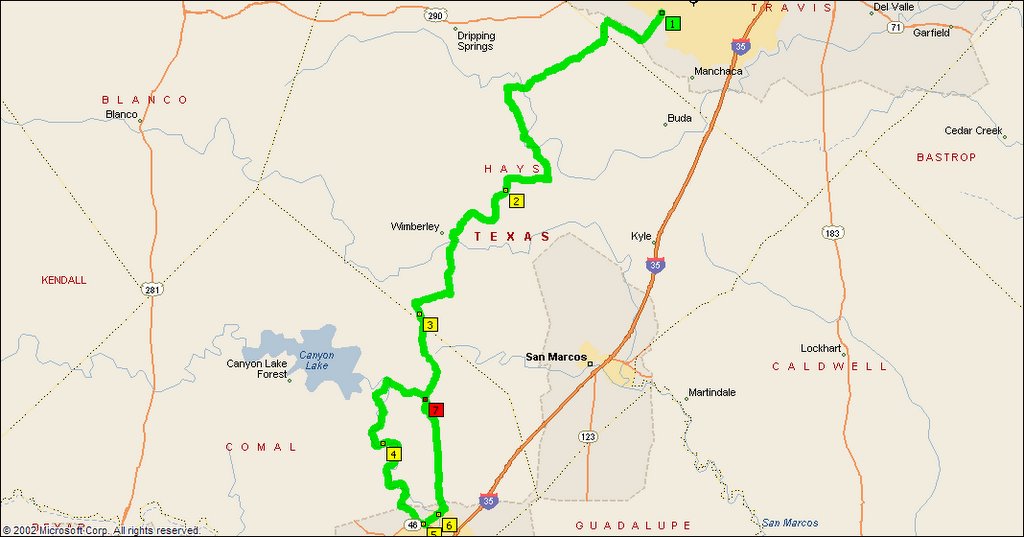
At Hays City, I made a right on FM3237 to make towards Wimberley. This
is more good Hill Country riding, not as many curves and hills as 150, but
it does allow me to come to Ranch Road 12 south of Wimberly, so I can
avoid the c-f that town has become on weekends.
Once on 12, I head south across the Blanco River and on to Ranch Road
32, where I head west for a bit, then turn south on Purgatory Road, which
is named for Purgatory Creek as it is a well maintained, low-traffic
county road. At the southern terminus, I turned to the west on FM306, in with
the Canyon Lake-bound traffic. In just a few miles, I turned again,
onto FM2673 toward Sattler. Once in Sattler, I turned on Sattler Road and
then onto River Road.
Like most River Roads, the Guadalupe River Road is well worth exploring
on a motorcycle. Beautiful views and lots of curves, both of the asphalt
variety and the human type, as many people enjoy spending a hot summer
day floating down the river on tubes. Beware, though, the 20 mph speed
limit is strictly enforced. In 10 miles of road, I saw 7 Comal County
deputies, several with cars pulled over.
After that refreshing interlude, I turned left onto TX46 then took the
Rock Street exit, which leads to Gruene (pronounced Green) Road, which
leads to, oddly enough, Gruene.
I was lucky to find a parking spot right by the cop directing traffic,
and walked across the street to Gruene Hall, where the Greencards were in
the middle of a smoking set, playing to a packed house of hot, appreciative
fans. This group is well worth seeing if they appear in your area.
They recently toured with Bob Dyan and Willie Nelson.
After staying for another set, the heat started getting to me so I
headed out. Some afternoon thunderclouds were building to the west, so I
opted for a more direct route home. From downtown Gruene, I went northeast
on Hunter Road to FM306, which I took northwest to Purgatory road, from
there I returned to my house by a reverse route from the outbound leg,
stopping in Hays City for gas (3.19/gal for premium) and a Hays City
Burrito (smoked brisket, pico de gallo, and cheese in a tortilla.)
The storm clouds stayed at bay for the most part, only 1 brief shower
marred the day, and rain felt cool.
The total trip was about 120 miles, and at least that many smiles.
Sunday, February 05, 2006
Super Sunday

It was clear here in Sacramento today, with the temps forcast to be in the 60s. I hopped on the bike, noting that the temperature seemed a little cool.
I headed south on the levee highway, Cal route 160. I have reported on this road before, it follows the Sacramento River south through the Delta to the Bay. When I say it follows, I mean it follows, with long, sweeping curves, right on top of the levee most of the way. Quite a few bikes out today, and there were a few boats moving on the river. There were even a couple of Jetskis out, the riders were fully dressed.
After a short wait at the Threemile Slough drawbridge for a passing tug, I took 160 all the way to Antioch, where I hit 4 east toward Stockton. As I went by the Union Point Marina I noticed they were doing a booming business, with about 15 bikes parked out front. I would have stopped in to check my fluid levels, but there were other fish to fry today.
Rolled into Stockton to the Elks Lodge, where I met up with a DOF, a Saint, and TNFH. A real stroke of timing had us arriving at the exact same time. The only reason that happened was my skill at taking a 40 mile ride down the Interstate and turning it into a 110 mile back road adventure.
At the Elks, we enjoyed some really good jazz performed by the Natural Gas Jazz Band, and the DOF shared some Earthquake McGoon's memorbilia with the members of the band, some of whom played there and one of whom helped produce a book about the place. For those who don't know, McGoon's was a jazz club in San Francisco where the DOF and the Saint used to spend time. The doors from the Pier 39 location were obtained by said DOF, and are slated to be the Saloon doors.
After an utterly enjoyable, and utterly too short a time, I had to take my leave, to attend a Super Bowl party hosted by a coworker. I left Stockton and blasted north on Rt 99. I would have stopped in Lodi, but was afraid I'd be stuck there, so I kept going. I turned off of 99 onto Grant Line Road, taking that all the way to Folsom, to my coworker's house. I was late for the kickoff, so I listened to the start of the game on the Electra Glide's radio.
I left his house when the fourth quarter started, so I could pop home before the parties let out. Just a straight romp down Rt. 50, north on 5, another stop for gas, and put the bike to bed.
Close to 200 miles, nice, enjoyable day. The inner fairing temperature guage did reach 60 degrees, when I left the bike parked in the sun.
Saturday, January 28, 2006
Break-in Ride
Dave asked me, "How was your break-in ride today?"

It was wonderful, and I hit the magic 500 mile mark.

I left the Natomas area, headed south on I5.  Took the CA 160 exit, and
rode along the river going south. My thinking was to go south on 160
and back on 84, if the Ryer Island ferry was running (I couldn't tell from
the CalTrans web page, a ferry on 84 wasn't operating due to high water,
but it didn't use the Ryer Island ferry name.)


I enjoyed the putt down 160, mostly on top of the levee, with lots of
curves, not many hills.  I plumb forgot that I had to cross the river
at Rio Vista on hwy. 12 to take 84 north, so I continued south on 160
until the river opened up some and I figured out I went too far.

I turned around, headed north on 160 as far as Freeport, where I
crossed the river and continued north on E9, the river road on the west side of
the river.  That took me into West Sac, where I rode by the
warehouse/office we are leasing for my project that I will have my
office in (and a place to park the bike, so I can drop the storage room I'm
keeping it in now.

Then I stopped by the local pub, for a cold beverage and to watch the
Redskins attempt to play football.  The cook didn't come to work until
5, so I didn't get anything to eat, so I took the bike to its spot then
hit the hotel for the end of the game.


Some observations:

I like the levee roads.  Not much traffic, lots of scenery, enough
curves to keep it interesting.

The Electra Glide, although much heavier than the Triumph, has a much
lower center of gravity and is real easy to handle at low speeds.

I like the tour pack.

The stock pipes are loud enough for me.  Any louder, and I'd have
trouble hearing the stereo.

All in all, I'm glad I bought this bike, and expect to put a lot of
miles on it exploring the Northern California area.
![]()